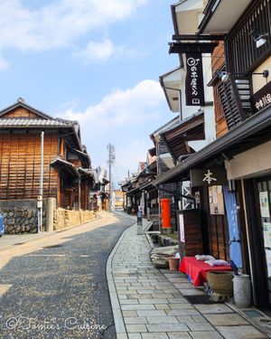
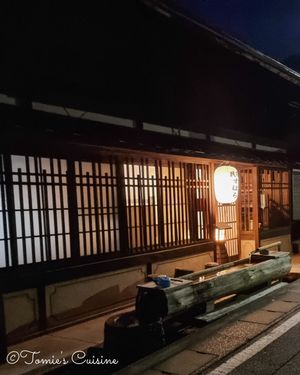
This is where our 19-day Nakasendo journal begins. Read it day by day, or planning your own walk? Start with our Nakasendo planning guide.
We love hiking and discovering new scenery on foot. We believe these activities let you experience a country's culture more personally, talk with locals, try regional cuisine, and explore its history. If you’ve read our blog before, you may have come across our previous articles about the Pyrenees or our shorter trips through France and Japan.
What is the Nakasendo?
The Nakasendo is one of Japan’s five main roads:

- Nakasendo (中山道): Between Tokyo and Kyoto through the mountains.
- Tokaido (東海道): Between Tokyo and Kyoto along the Pacific Ocean.
- Koshu kaido (甲州街道): Tokyo to Nagano, through Yamanashi Prefecture.
- Ooshu kaido (奥州街道): Tokyo to Fukushima Prefecture.
- Nikko kaido (日光街道): Tokyo to Tochigi Prefecture.
People have used and maintained these roads since the Edo period. The Nakasendo, with its 69 stations, is the longest.
Our journey

In March and April 2025, we travelled the Nakasendo from Kyoto to Tokyo in 19 days. The Nakasendo is a 534 km historic road, and our route came to 564 km: we walked from Kyoto for 18 days, then cycled the last stretch into Tokyo. Along the way, we crossed seven prefectures, climbed mountain passes, slept in business hotels, guesthouses, and a converted school, and ate our way through more regional food than we can count.
We’re now writing up the whole journey day by day, from Sanjo Ohashi bridge in Kyoto to Nihonbashi in Tokyo: what the road is like, the post towns we passed through, where we stayed and what we ate. If you’re thinking of walking some or all of the Nakasendo yourself, we hope it helps you picture what’s ahead.
Our Nakasendo itinerary: 19 days from Kyoto to Tokyo

We could have shortened this schedule, but we wanted enough time to explore and visit museums related to the history of the Nakasendo, or enjoy food at a local restaurant, which turned out to be the right decision.
We decided to finish this trip by bike because we enjoy walking in nature, but we don't particularly like walking on paved roads in busy city areas. Cycling lets us take in the surroundings while spending more time outdoors. Instead of rushing, we stayed in Tokyo for two nights to sightsee before heading to my hometown to visit my family.
What is Japan’s climate in early spring along the Nakasendo?

In March and early April, Japan is starting to warm up. Days can be pleasantly mild, but mornings and evenings are cold, and it gets colder the higher you go. The mountains in Gifu and Nagano, especially the Kiso Valley and the passes after it, can still have snow on the ground.
We had a bit of everything. Day 3 to Kashiwabara was cold and wet, and that evening's hot bath at our guesthouse felt like the best thing in the world. In Magome, the March evening was cold enough that we were grateful for the heating, and the night after Wada Pass, at altitude, was the coldest of the trip. Pack for all four seasons: we’ll tell you more about the surprises in each day’s article.
Budget
We kept this trip budget-friendly. Most nights cost us between ¥7,100 and ¥13,000 for a room for two, and we ate mostly in family restaurants, supermarkets and convenience stores, with the occasional local speciality we couldn’t walk past. Here’s how we approached the two highest costs: where to sleep and what to eat.
Where we stayed on the Nakasendo

Since this trip lasts 19 days, we stayed in reasonably priced hotels along the Nakasendo. In cities, we mainly chose “business hotels” (similar to Travelodge in the UK), which offer clean rooms with bathrooms at lower prices. We've documented every place we stayed in our complete accommodation guide: 19 places to stay, 20 nights, with the prices we actually paid and alternatives.
In the countryside, like in Magome, we booked accommodations with shared bathrooms. However, some places may charge for items like bath towels or toothbrushes, so it's a good idea to bring your own.
Occasionally, we couldn't find a hotel close to our destination, but there was a nearby train station. In those cases, we took a train to the hotel and returned to our starting point the next day. This approach worked well for us.
Camping
It would have been fantastic to camp as we did on the GR10 trail, but it can be tricky to determine whether the land is public or private. We didn't want the hassle of contacting each landowner for permission. Fortunately, we found it relatively easy to secure accommodations along the Nakasendo, as this route was designed in the 1600s with many stations for travellers.
Food

Food was one of the best parts of the trip. We passed through seven prefectures, from Kyoto to Tokyo, and almost every stretch had its own speciality: gohei mochi, grilled rice cakes glazed with a sweet sauce, on Day 9 in Magome; a bowl of soba in the evening after a long day; and sanzoku-yaki, Nagano’s crispy fried chicken, in Shiojiri.
To keep costs down, we mostly ate at family restaurants, supermarkets and convenience stores, and saved our splurges for local dishes we’d never find at home. In each day's article, we share what we ate and where, so you can spot them on your own walk.
What’s in our backpacks?
We packed for every kind of weather: warm, sunny days; cold, windy ones; rain; and the chance of snow. Alongside our clothes, we carried hiking sticks, a torch, a Kindle loaded with a Nakasendo guidebook, snacks, a first aid kit and a few other essentials.
A full packing list, with what we used every day and what we could have left at home, is coming soon. In the meantime, many of the things we took are in our holiday gift recommendations for hikers and outdoor lovers.
Closing words

That’s the big picture. The best way to follow the whole journey is day by day, starting in Kyoto: Day 1: Sanjo Ohashi to Kusatsu. You’ll find every published day, in order, in our Nakasendo journal.
This is the longest series we’ve ever written for Tomie’s Cuisine, and there’s still plenty to come, from the Kiso Valley post towns to the last stretch into Tokyo. If you have questions or want to see more road photos, find us on Instagram, Pinterest, or Facebook. We’re always happy to help.
Not ready to buy yet? Read the first 35 pages of the Nakasendo Field Guide free →
| Day | From → To | Prefecture |
|---|---|---|
| Day 1 | Sanjo Ohashi, Kyoto → Kusatsu | Kyoto → Shiga |
| Day 2 | Kusatsu → Echigawa | Shiga |
| Day 3 | Echigawa → Kashiwabara | Shiga |
| Day 4 | Kashiwabara → Akasaka | Shiga → Gifu |
| Day 5 | Akasaka → Kano | Gifu |
| Day 6 | Kano → Ota | Gifu |
| Day 7 | Ota → Hosokute | Gifu |
| Day 8 | Hosokute → Ooi | Gifu |
| Day 9 | Ooi → Magome (Part 1 · Part 2) | Gifu |
| Day 10 | Magome → Suhara | Gifu → Nagano |
| Day 11 | Suhara → Miyanokoshi | Nagano |
| Day 12 | Miyanokoshi → Seba | Nagano |
| Day 13 | Seba → Shimosuwa | Nagano |
| Day 14 | Shimosuwa → Nagakubo | Nagano |
| Day 15 | Nagakubo → Iwamurada | Nagano |
| Day 16 | Iwamurada → Karuizawa | Nagano |
| Day 17 | Karuizawa → Annaka | Nagano → Gunma |
| Day 18 | Annaka → Honjo | Gunma → Saitama |
| Day 19 | Honjo → Fukaya (on foot) | Saitama |
| Day 19 | Fukaya → Nihonbashi (by bike) | Saitama → Tokyo |